Transportaion
Černá v Pošumaví is easily accessible by both car and public transport. The nearest larger town is Český Krumlov (about 30 km), from where bus connections run directly to the village. If you are traveling from Prague, the drive takes approximately 2.5 hours (160 km), while by train and bus it takes about 3.5 hours with transfers. The nearest train station is located directly in Černá v Pošumaví on the line from České Budějovice.
For getting around the area, it is ideal to have your own car or use bike and e-bike rentals. During the summer season, a cycle bus and boat transport on the reservoir also operate here. The village offers basic infrastructure – bus stops, parking, tourist signage, and an information center.
idos.cz
IDOS (Information System about Transport) is the official Czech online system that allows you to search for and plan journeys using public transport throughout the Czech Republic and abroad. The system includes timetables for trains, buses, city transport, and other means of transport, including connections between them. With IDOS, you can easily find routes, departure and arrival times, ticket prices, and other useful information. It is available via website and mobile app.
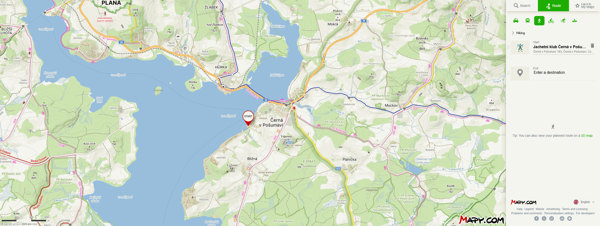
mapy.cz
mapy.cz is a Czech online map and navigation service ideal for tourists and travelers. It offers detailed tourist, cycling, and standard maps, including marked trails, points of interest, lookout towers, and restaurants. You can plan trips, download maps for offline use on your mobile device, and use navigation directly in the field. Thanks to detailed contour lines, photos, and user reviews, it is a great tool for discovering new places, even in less-known areas of the Czech Republic and neighboring countries. Mapy.cz is often more detailed than services like Google Maps because it shows not only marked tourist paths but also ordinary footpaths that you won’t find elsewhere. It is available for free as a website and a mobile app.
mapy.cz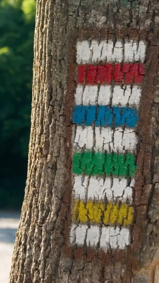
Turistické značení
The Czech Republic offers over 44,000 km of marked hiking trails, making it a paradise for nature and hiking enthusiasts. The trails are marked with four main colors — red, blue, green, and yellow — each indicating a different type of route.
- Red trail marker: Main, long-distance, or ridge routes that often cross multiple regions. They are suitable for longer hikes.
- Blue trail marker: Important regional routes, usually longer paths connecting interesting places.
- Green trail marker: Local and regional routes, ideal for shorter hikes or exploring the surrounding area.
- Yellow trail marker: Connecting routes, shortcuts, and very short paths.
A dashed line on the map indicates local walking trails. It can represent a footpath, a provisional boundary, or a section of road that is not yet paved. The exact meaning of the dashed line depends on the context within the map.
This marking system was first introduced in 1889 by the Czech Tourist Club. The maximum distance between markers is 250 meters, and each marker measures 10 × 10 cm. If a trail suddenly changes direction or turns onto another path, an arrow is added to the basic marker to indicate the correct way.
To view specific hiking trails on mapy. cz you need to zoom in on the desired location or switch from the basic map to the outdoor map. Then, the individual trails and their color markings will be displayed.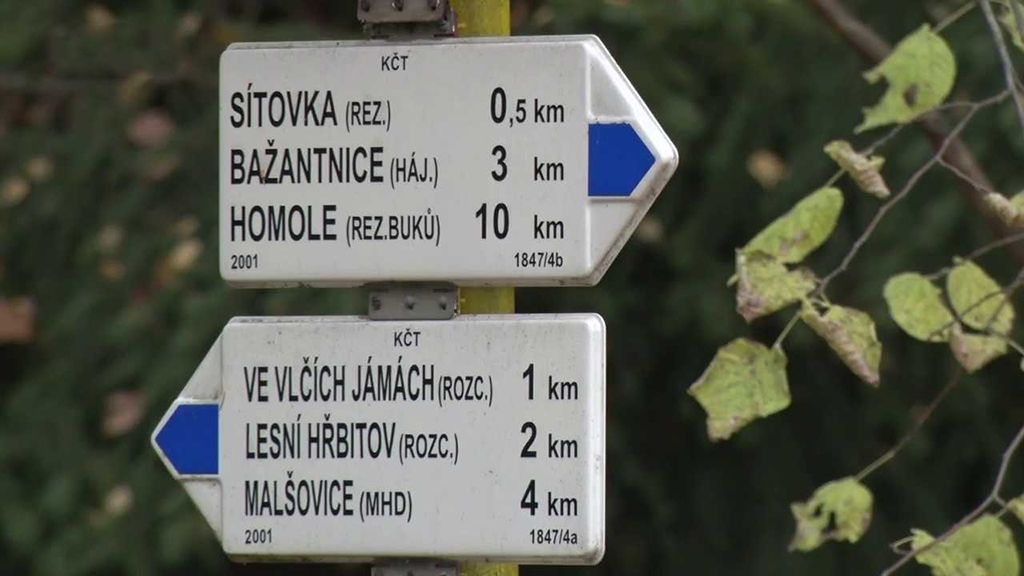
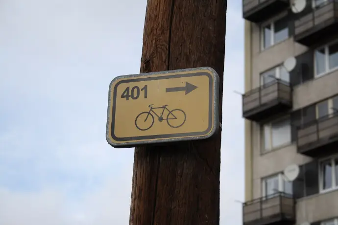
Cyklotrasy
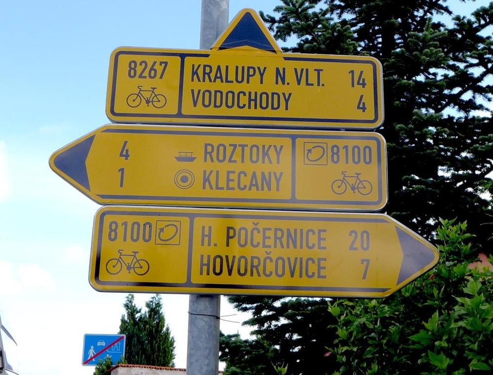
Cycling routes in the Czech Republic are marked with yellow directional signs featuring black numbers, often accompanied by a bicycle pictogram and an arrow indicating the direction.
- National cycling routes have one- to two-digit numbers (for example, No. 2 – Elbe Trail) and connect significant regions of the country.
- Regional cycling routes are marked with three-digit numbers and connect towns and tourist attractions.
- Local cycling routes have four-digit numbers and are used to connect smaller villages and local roads.
At cycling route intersections, you’ll find directional signs with distance information, information boards with maps, warnings about hazardous sections, or suggested detours.
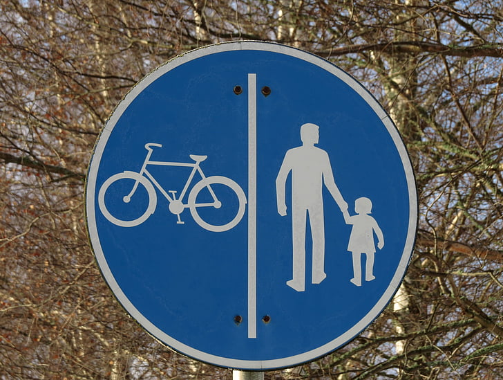
It’s important to distinguish between a cycling route (cyklotrasa) and a cycle path (cyklostezka). A cyklotrasa can follow various types of roads – including paved roads, dirt tracks, or forest paths – and is marked with yellow signs. In contrast, a cyklostezka is a dedicated path exclusively for cyclists, marked with a blue circular sign labeled “Stezka pro cyklisty” (Cycle Path).
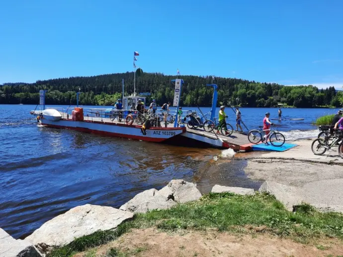
Ferry
The ferry on Lake Lipno is a great way to enrich your trips around this scenic area. It connects various parts of the Lipno reservoir shoreline and offers a convenient and quick way to cross the water, saving time and providing a unique boating experience. The ferry is suitable for hikers, cyclists, and families with children, and is especially popular during the summer season.
Timetables can be found here: lipno-in.cz